
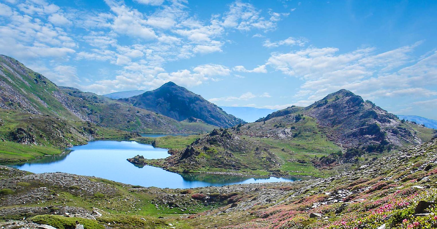
Lake of Bouillouses
Lac des Bouillouses
A protected natural site in the heart of the Pyrenees: an early 20th-century dam, trailheads to the Carlit lakes, fishing, panoramas and mountain inns. Perfect for a “Lake & Mountain” escape.
History
Status: protected natural site since 1976 – strict conservation of habitats. Please stay on marked trails.
- Uses: drinking water, irrigation, hydropower, low-impact tourism.
- Toponymy: from Catalan bullosa, “bubbling”.
- Heritage: emblematic structure of the Pyrénées-Orientales.
Geography
- Department: Pyrénées-Orientales (Occitanie)
- Municipalities: Les Angles, Angoustrine-Villeneuve-des-Escaldes
- Outflow: the Têt river (towards the Mediterranean)
Location & access
- From Les Angles: summer shuttle to the dam (frequency varies).
- From Font-Romeu / Mont-Louis: access via the D60 road (subject to regulations).
- Mountain weather: bring warm layers, water, sun protection & a map.
Tip: search for “Barrage des Bouillouses” to park close to the main trailheads.
Activities
Walks & viewpoints
- Partial loop along the shores (family-friendly, little elevation gain).
- Viewpoints over the dam and surrounding ridges.
- SENSITIVE AREAS: follow all on-site signage.
Fishing (regulated)
- Brown trout, rainbow trout, Arctic char.
- Fishing licence & open seasons: check before you go.
Beyond the lake
- Carlit lakes (chain of glacial lakes).
- Pic Carlit (2,921 m) for experienced hikers.
Hikes (selection)
“Lower lakes” loop
- Distance: ~6–7 km • Elevation gain: ~200 m • 2–3 h
- Via Estany de la Pradella, Negre, Llarg…
- Very scenic, great for families.
Pic Carlit via the lakes
- Long alpine hike (good weather essential).
- Start near the dam • rocky sections.
- Huge Pyrenees / Mediterranean views in clear conditions.
Safety: mountain weather changes quickly, with possible afternoon storms in summer. Take an IGN map, water, warm layers and respect all protected areas.
Restaurants & accommodation
Les Bones Hores (lakeside)
Mountain-style cuisine with lake views. Booking recommended in high season. Official websiteAuberge du Carlit (Les Angles)
Practical option for hikers: rooms & half-board options. Info & bookingOther hotels & huts
Depending on the season: hotels in Les Angles, Font-Romeu, Mont-Louis + nearby mountain huts. Les Angles tourism officeUseful links
Stay in the heart of the Catalan Country and the Roussillon
Two unique retreats between sea and mountains: design, comfort and Mediterranean light. Choose your home — we’ll handle the rest.
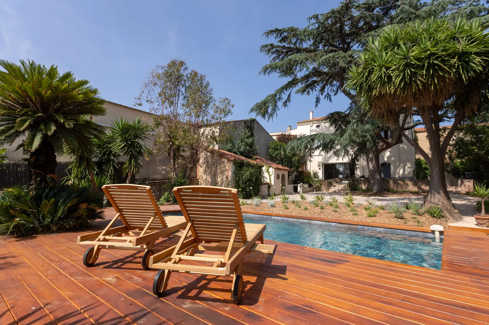
🏡 La Bastide du Cèdre – Tresserre
Elegant Catalan bastide surrounded by vineyards, close to Spain. Sunlit pool, wide open spaces and a refined Mediterranean atmosphere — the perfect base to explore the Catalan Country and the Roussillon.
Check availability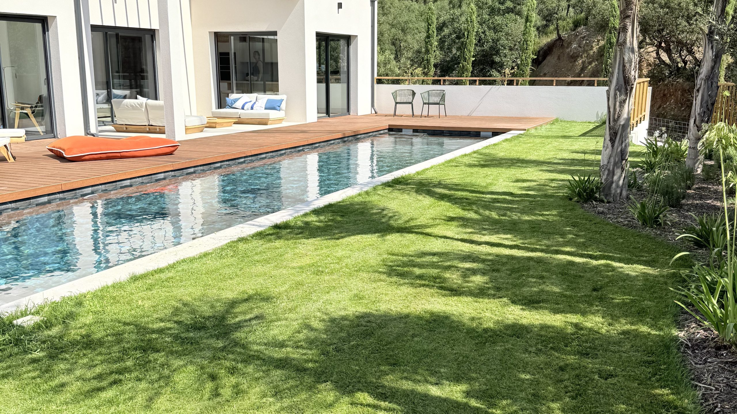
🌿 Villa de la Subérine – Vives
Cork oak trees, mountain views and peaceful golden evenings. A contemporary villa for those seeking the calm, authentic side of French Catalonia.
Check availability